
Can You Trust Old Maps of Paris?
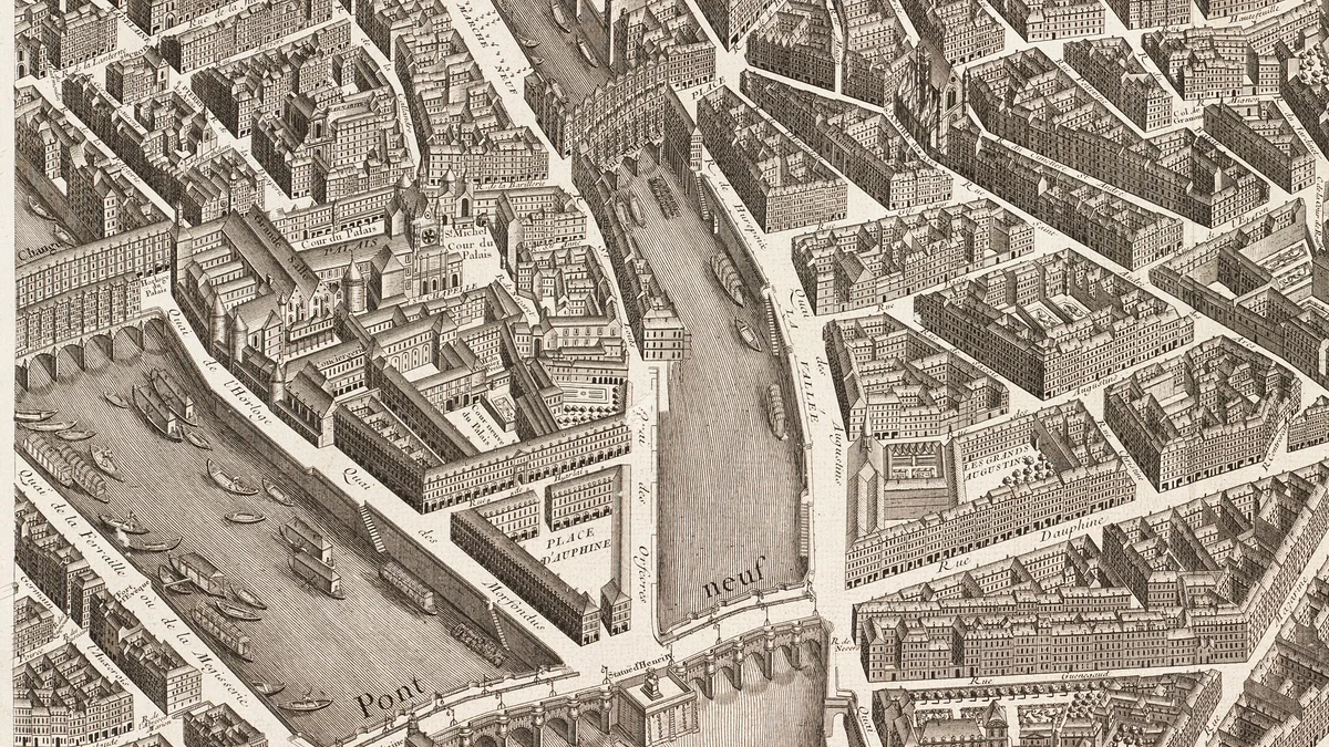
You have seen them, whether you know it or not: those bird’s-eye views of Paris where every single house is drawn one by one, shared endlessly online and framed in every hallway. The Turgot map, reprinted again and again since 1739, is one of those images nobody questions any more. And precisely because it is magnificent, the awkward question needs asking: is it accurate?
Yes and no, and our whole craft lives in that nuance. The Turgot map (1734-1739) is remarkably precise for street layouts and monuments, but it embellishes deliberately: its streets are widened so the façades stay visible, the city is frozen, without building sites or crowds, and the whole thing was a prestige operation. An old map is a witness, not a photograph: it shows what its patron wanted shown. Which is why a serious reconstruction always crosses maps with other sources.
A masterpiece of precision, commissioned as an advertisement
Let us first give the object its due. In 1734, Michel-Étienne Turgot, the provost of the merchants of Paris, commissioned a great map of the capital from Louis Bretez, academician and professor of perspective. Bretez spent two years surveying the city, armed with a pass that let him enter private mansions, houses and gardens to draw what the street does not show. Engraved by Claude Lucas and completed in 1739, the result is a paper monument: twenty plates which, assembled, form a view 2.49 by 3.18 metres, on which every house in Paris is represented.
But the commission must be read along with the map. As Stéphane Blond’s study for L’Histoire par l’image shows, the goal was to glorify the capital and its municipality: a prestige plan, staging the city’s latest improvements, from the new quays to the street lighting. An advertisement, in the proper sense.
What the map arranges
Here the deep dive begins. So that every façade would stay visible, Bretez used the so-called cavalier perspective, without a distance point: buildings in the background keep the same size as those in the foreground. Above all, the streets are drawn wider than they really were, otherwise the houses would hide one another. The map’s authors admitted as much at the time: without these “licences”, they explained, part of the most interesting subjects would have been lost.
Turgot’s Paris is also a frozen Paris: no building sites, though the city was covered in them, no crowds, no mud. An ideal city, stopped in demonstration light. Anyone who has read descriptions of the real, narrow, cluttered Paris of the 18th century can measure the gap between the engraving and the lived experience.
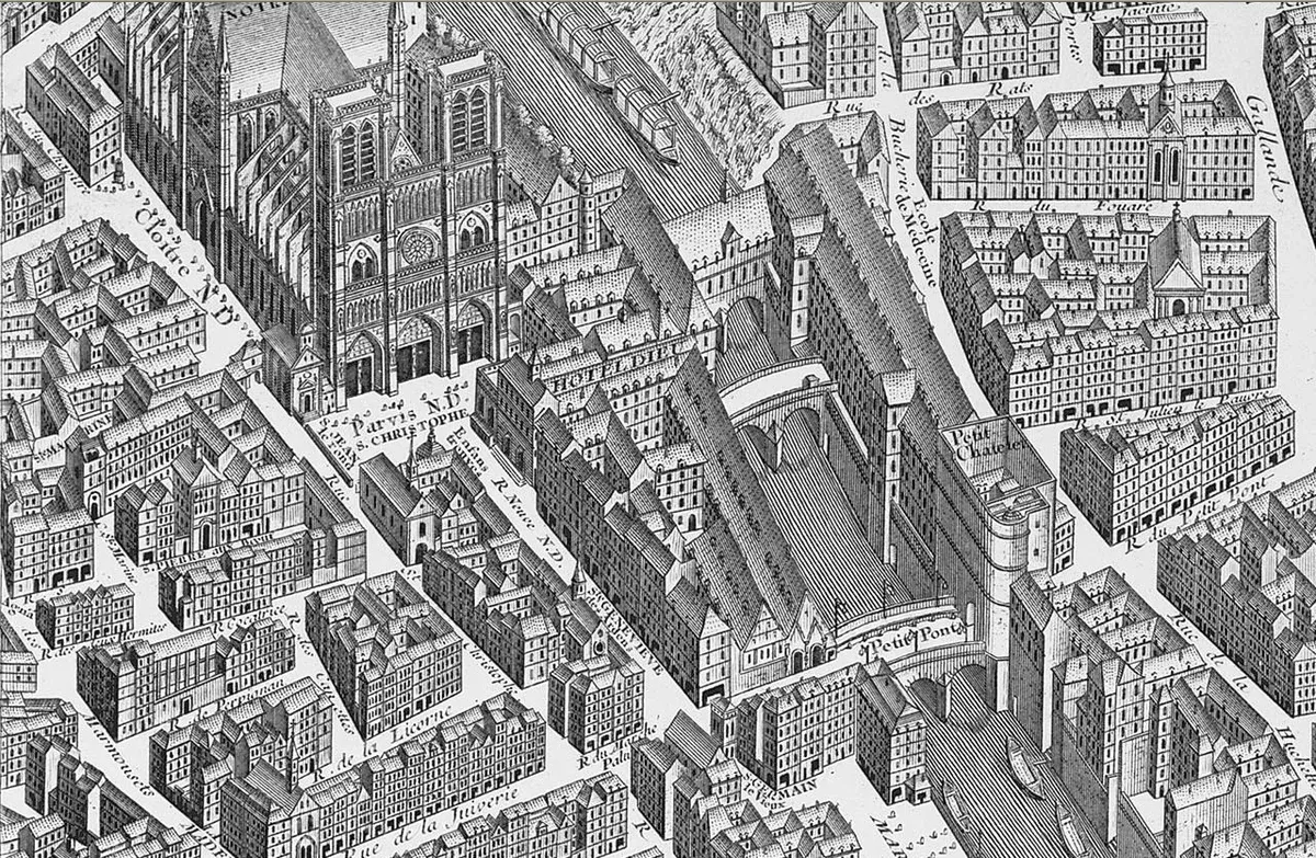
The rue Neuve-Notre-Dame on the Turgot map: the very street whose foundations the parvis excavations are unearthing today.
The dean of Paris maps, and its limits
Go back two centuries. One of the oldest surviving maps of Paris, known as the Basel plan, is a woodcut from around 1550, made under Henri II by Olivier Truschet and Germain Hoyau. Only one copy is known, rediscovered in 1874 in the collections of the University of Basel, hence its name. Eight sheets which, assembled, compose a Paris one metre thirty wide, precious beyond measure: the gates, the mills, the brand-new city hall, the tight parcelling of gable-fronted houses.
Its limits are of a different kind from Turgot’s: at that date, no exact survey of the city existed, and a woodcut view cannot draw every house from life. You recognise Paris in it; you do not measure it. In the detail below, the place de Grève and the pont Notre-Dame loaded with houses, the very bridge whose story we tell in our article on the inhabited bridges.
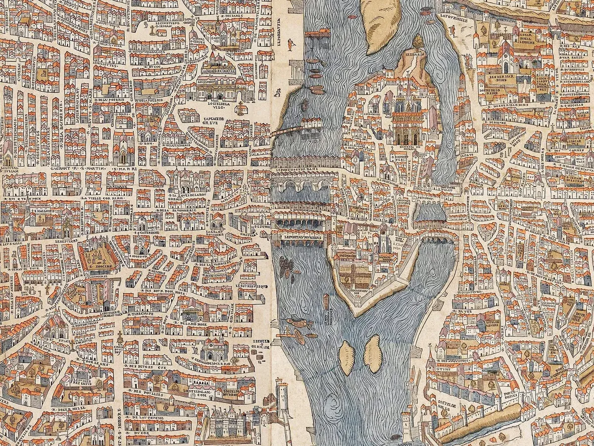
On the Basel plan, circa 1550: the place de Grève, and the bridges still carrying their houses.
As for Paris before 1550, it simply has no map: for the île de la Cité of 1431, no contemporary map exists. There, you work with texts, illuminations, account books, and the ground itself.
How we use them (and how we do not)
So what do you do with these maps when reconstructing the Paris of the past? You treat them as witnesses: precious, but with a point of view.
- What we take from them: the layout of streets and plots, the position of monuments, gates, mills and signs, the general silhouette of each quarter. On all of this, Turgot and Truschet-Hoyau are gold mines.
- What we check elsewhere: street widths, building heights, the actual state of structures. We cross-reference with archives, registers, painted and engraved views, and with archaeology, which has the final word: when the excavations on the parvis of Notre-Dame bring the walls of a vanished quarter out of the ground, the walls are right, not the engraving.
- What we never copy: the atmosphere. The frozen, clean city of the prestige plans is exactly what an honest reconstruction has to unlearn: the real Paris had building sites, congestion and noise.
That is the method we apply scene by scene in The Origins of Paris, under the oversight of our scientific committee: the place de Grève you watch come back to life through our virtual-reality binoculars owes its layout to the old maps, and its life to everything the maps do not show. Our behind-the-scenes page details these trade-offs, and our deep dive on AI explains why a seductive image is not an accurate one; the problem did not start with generative models.
The questions we get asked
Is the Turgot map reliable? For locating a street, a monument or a plot in 1739, yes, remarkably so. For picturing the atmosphere, the real street widths or the state of the buildings, no: it idealises, and that was its brief.
What is the oldest map of Paris? Among the oldest that survive: the so-called Basel plan, engraved around 1550 by Truschet and Hoyau under Henri II, known from a single copy rediscovered in Basel in 1874. The city’s very first maps date from that mid-16th century: medieval Paris has to be reconstructed without one.
Where can you see these maps? Both are online: the Turgot map digitised on Gallica, the Basel plan republished by the Institut Paris Région. Free, zoomable, and hours will disappear into them.
In short
The old maps of Paris are admirable, interested witnesses: Turgot widens its streets and freezes its city, the Basel plan recognises more than it measures, and each shows the Paris its era wanted seen. Trust them for the geography, never for the atmosphere. An honest reconstruction starts there: loving these images, and knowing exactly where they bend the truth.
Sources
- “Plan de Paris, dit plan de Turgot”, Passerelles, Bibliothèque nationale de France (in French).
- Stéphane Blond, “Le Plan de Turgot”, L’Histoire par l’image, 2016 (in French).
- “Plan de Paris en 20 planches, dessiné et gravé sous les ordres de Michel-Étienne Turgot”, digitised facsimile, Gallica / BnF.
- “La Ville, Cité et Université de Paris, dit ‘plan de Bâle’”, Institut Paris Région (in French).
- Images: Turgot map, plates digitised by the Norman B. Leventhal Map Center (public domain); Basel plan, coloured copy (public domain, via Wikimedia Commons).